

Archive Record
Images
Metadata
Title |
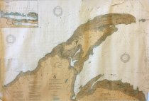
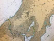
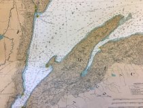
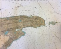
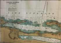
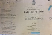
Chart of Lake Superior Coast from Big Bay Point to Ontonagon including the Keweenaw peninsula |
Catalog Number |
A-2020.Fic.233 |
Object Name |
Chart, Navigational |
Pub Date |
1926 |
Scope & Content |
Coastal waters with depths, land formations including railroads, cities and towns, lakes, rivers, bays, points etc. The Portage canal, cities of Calumet, Ontonagon, Houghton and Hancock are all shown. Locations of numerous stamping mills and mines are also included. Lake water is white with shore depths in shades of blue. An inset showing Copper Harbor and Fort Wilkins is included. This is a beautiful map. |
Map Language |
English |
Collection |
Map Collection |
Search Terms |
Upper Peninsula - History Upper Peninsula Maps |
Subjects |
Charts Harbors Lake Superior Mills Mines Rivers Shorelines |
Publisher |
U.S. War Department |